
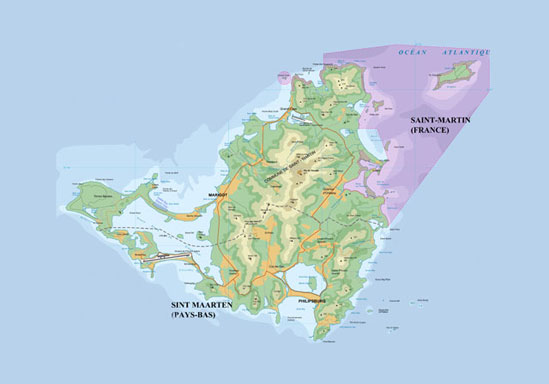
Notes on Conservation and Selected Areas of Interest
On the following pages I have chosen to highlight a few selected areas of interest that represent some of the major types of habitat on St. Martin. Before I do so, it is necessary to mention that every part of the island has suffered from destructive human involvement.
During colonial times, nearly all of the natural vegetation was destroyed for agriculture, and it can be assumed that all or nearly all the existing forest on in the central mountains and elsewhere is secondary growth. Although the Wilderness area at the northeast tip of the island remains undeveloped, the presence of introduced mongoose has severely impacted reptile populations. Most undeveloped lowland and hill areas have been radically transformed by grazing cattle and goats. Even the uninhabited offshore islands are home to invasive species including rats, mice and goats.
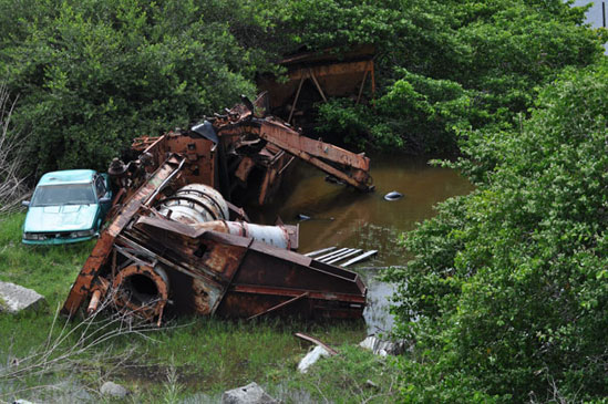
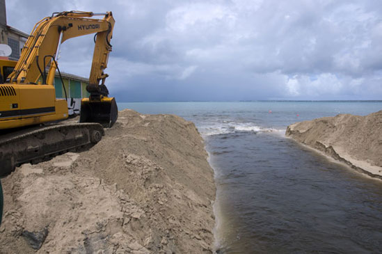
In more recent times, massive population growth and the development of a large tourism industry has put additional strain on the island. As late as the 1960s the population of the island was estimated to be around 5,000 people. Today, it is close to 80,000, with an estimated one million or more tourists per year. Every salt pond and mangrove wetland on the island is polluted and the largest cave on the island was filled in during development in the 1990s. A large area on Hope Hill is currently being mined for building materials, while new resorts and an expanded airport have been expanding into the lagoon and nearby mangroves. Near Baie Longue, an overloaded waste treatment center discharges raw sewage into the sea a few hundred meters offshore.
Development takes place with little or no consideration for the environmental impact, and the budget does not seem to exist to handle refuse and sewage for an increased population. These factors do not bode well for the survival of the delicate ecosystems on the island.
There are, however, some bright spots in this otherwise gloomy picture. The French Reserve Naturelle de Saint Martin has set aside significant marine and terrestrial areas as a nature reserve. On the Dutch side, the Nature Foundation St. Maarten has established the St. Maarten Marine Park, which includes several islets that serve as breeding grounds for marine birds, and is hoping to establish a terrestrial park at some time in the future. A private business, Loterie Farm, maintains 135 acres on Pic Paradis as a private reserve and eco-tourism center. Through a combination of efforts, perhaps it will be possible to slow the destruction of St. Martin’s natural heritage.
Saint Martin is home to a rapidly growing population as well as large number of tourist visitors each year. Although some portions remain undeveloped, the strain imposed by humans on the local environment is readily apparent. Still, there are many areas where the beauty of the natural landscape and its inhabitants can be enjoyed.
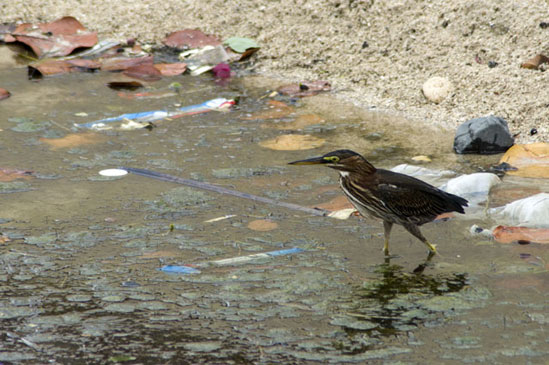
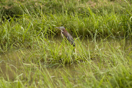
A green heron hunts in a trash filled canal. After being opened to connect the pond to the sea, the nearby bay filled with algae blooms within two weeks.
Unfortunately, the wetlands of the island are a dumping ground for visible trash as well as sewage and other forms of pollution.
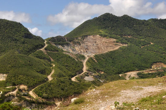
Mining for construction materials and the associated roads have permanently scarred the face of Hope Hill. During heavy rains, topsoil erosion from this area is clearly visible.
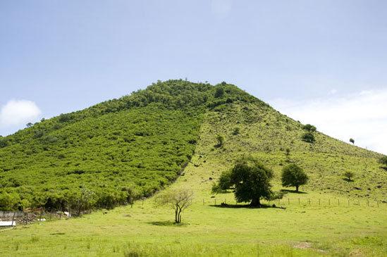
The line between forest and goat pasture is often stark, as seen on this hill. In the foreground the grounds of an abandoned business remain barren.
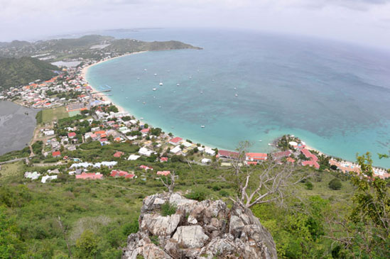
Coastal areas of the island are largely developed, although on the French side such development is on a much smaller scale.
Bell Point Area
I consider the Bell Point area to be the part of the island extending from Goat Mountain (officially known as First Stick Hill) to the tip of Bell Point as well as the valley leading out to Bell Beach. On the eastern side, smaller hills lead up to the edge of Anse Marcel.
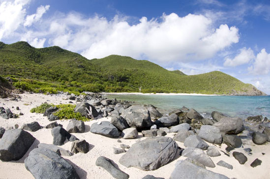
The southwest portion of this area includes the edge of Grand Case, but aside from the lower portions of Goat Mountain the area is mostly uninhabited. The line of hills extending to the point is topped with secondary forest, and the majority of the area is scrubland used as pasture for goats and cattle. There is a long rocky beach on the western side and Bell Beach is a small sandy beach at the end of the valley. A rocky cliff face leads from Bell Beach to the tip of Bell Point.
Although it is neither the prettiest nor most pristine area of the island, it is an excellent example of the hilly regions of the island, with some habitation at the lower elevations and mixed areas of pasture. Outside the towns and coastal resort areas, much of the island exists in a similarly degraded state.
On the hills it is interesting to note the relative defoliation due to grazing. In the areas with the densest goat populations, the ground is almost bare and rains wash significant amounts of soil into the sea. Areas grazed by cattle tend to contain more vegetation as a result of lower density. While occasional goats may be seen in the hilltop forest, they seem to have less impact there. Cattle apparently lack either the ability or the desire to enter those areas.
In Bell Valley, the mongoose is quite common. As a result, the ground lizard Amieva is totally absent. This is also where I found the raccoon carcass. The presence of raccoons may also contribute to the lack of Amieva in this area.
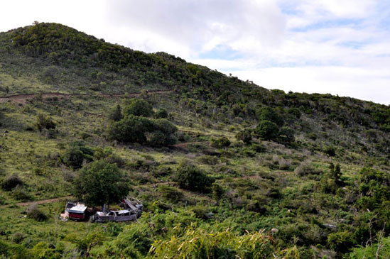
In this view of the hills leading out to Bell Point, a cattle shelter can be seen in the foreground. The scrub area serves as pasture for the cattle, while the top of the hills is covered with secondary forest.
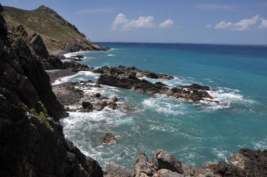
Seaside cliffs ring the area from Bell Beach to the tip of Bell Point.
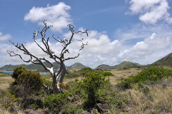
During the late winter and early spring dry season much of the groundcover dies and some trees shed their leaves to conserve moisture.
By summer, increased rainfall has enriched both the forest and the scrubland.
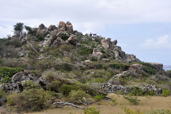
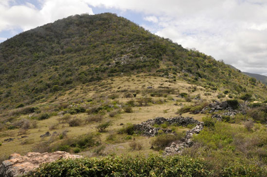
A small herd of goats surveys the landscape from the rocky outcrop at the tip of Bell Point.
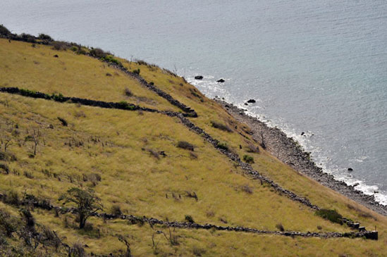
Near the tip of Bell Point, a large grassy area divided by old stone walls overlooks the long rocky beach.
A view from Bell Beach towards Bell Point looks quite pretty. Just off the beach to the left is a large area of mud where pigs wallow.
Wilderness
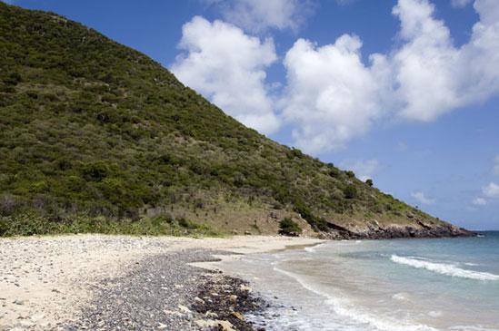
Wilderness is the largest undeveloped portion of the island, covering the northeastern point between Cul de Sac and Anse Marcel. A trail, which unfortunately begins at a landfill and ends at a sewage treatment plant, leads around this area, mostly near the shore. The small beach nestled in the middle, Petite Cayes, is probably the only place where you can swim out into the sea and look back on the island without seeing any evidence of humans.
The area includes long rocky beaches, a nice chunk of forest and a unique area of seaside vegetation that includes several varieties of cactus and a large variety of groundcover plants. Small signs along the trail identify many of the species found here.
The Amieva is quite rare in this area, probably due to the presence of mongoose. On the rocky shoreline, composed primarily of dead coral skeletons, Anolis gingivinus seems to occupy their niche.
The shoreline is an excellent place to see seabirds, particularly the magnificent frigatebird, perhaps because the area is exposed to the prevailing easterly winds.
The forested area along the trail between Petite Cayes and Anse Marcel is a bit different from the forests in the central mountains. Although it can be dense the trees are neither as tall nor as varied. This is likely due to the lower elevation and correspondingly less rainfall. One can’t help but wonder how much of the island would be like this if it hadn’t been cleared for agriculture.
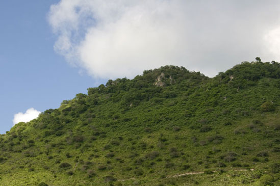
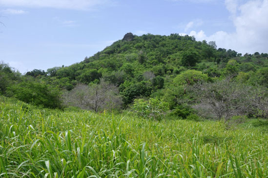
Red Rock, the peak in the center of this area is forested up its entire slope on the sea-facing side, making it rather unique in that respect. On the island side, pasture stretches up to near the top as it does on so many hills.
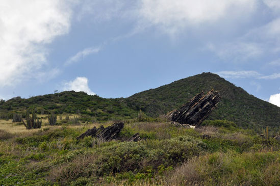
The sedimentary rocks in the foreground jut up at the same angle as the exposed rock in the hillside behind them. Originally a volcanic island, St. Martin was submerged, capped with limestone and then thrust up again.
The view of Petite Cayes and the mountains behind it is almost totally devoid of human development, making it a very important habitat for local wildlife.
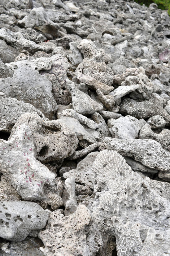
Much of the coastline at Wilderness is composed of dead coral skeletons from a variety of species washed up from the surrounding reefs.
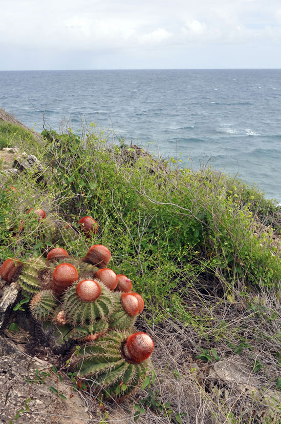
The barrel cactus Melocactus intortus is quite common near the windblown Eastern Point of Wilderness. It is also referred to as the pope cactus or Turk’s head cactus.
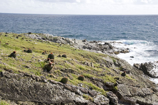
Eastern Point juts out into the waters of the Atlantic Ocean. A variety of low groundcover gives way to wave-battered rocks near the shore.
Central Mountains
A series of mountains runs more or less north-to-south through the center of the island. The tallest, Pic Paradis is a little over 400 meters tall. These central mountains are connected by a series of trails that runs along the length of the crest.
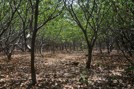
While not tall enough to support a cloud forest, the upper altitudes of the central mountains are quite densely forested and support various bromeliads and other epiphytes. At least most of the original forest was cleared during colonial times. It is possible that some areas of the original forest survived, but the remnants of stone walls are often found even in the highest forests.
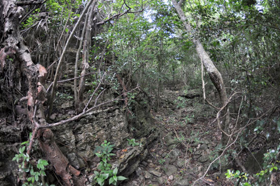
Numerous dry gulches run down the mountainsides offering natural paths to the peaks. During heavy rains these fill with water, and some small puddles may remain in rock cavities at least temporarily.
The forests of the central mountains are the primary habitat for a variety of organisms including helicinid snails, certain orb-weaving spiders and a variety of insects. The anole Anolis pogus and the two species of dwarf gecko are also common in these forests.
The forest may be referred to as semi-evergreen seasonal forest as a minority of trees do lose their leaves during the dry season. This type of forest is also called tropical dry forest, distinguishing it from rainforest or cloud forest. Although they receive less attention, tropical dry forests can have a level of diversity approaching that of rainforests. In some ways they are at more risk than rainforests, as only a minute fraction are currently protected and they are easily cleared for agriculture.
Hopefully this area will remain relatively undeveloped in the future. In addition to their environmental value, these mountains offer a scenic beauty that significantly enriches the island.
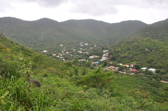
The town of Colombier lies nestled at the foot of the central mountains. As can clearly be seen, this area is the most verdant part of the island.
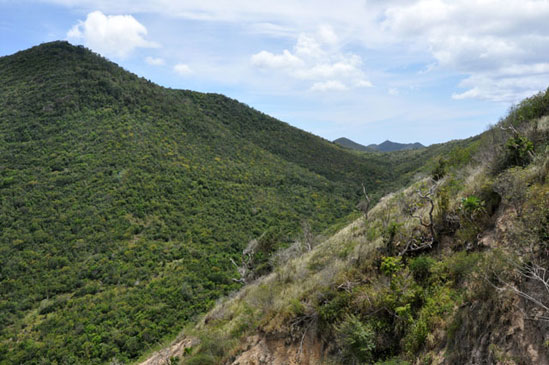
Despite the rapid pace of development on the island, the central mountains still contain large areas of undeveloped tropical dry forest.
Dense forests are home to a variety of plant and animal life, at times approaching the level of biodiversity present in rainforests.
Mountain clearings are a reminder of the colonial deforestation that stripped the forests from the majority of the Lesser Antilles.
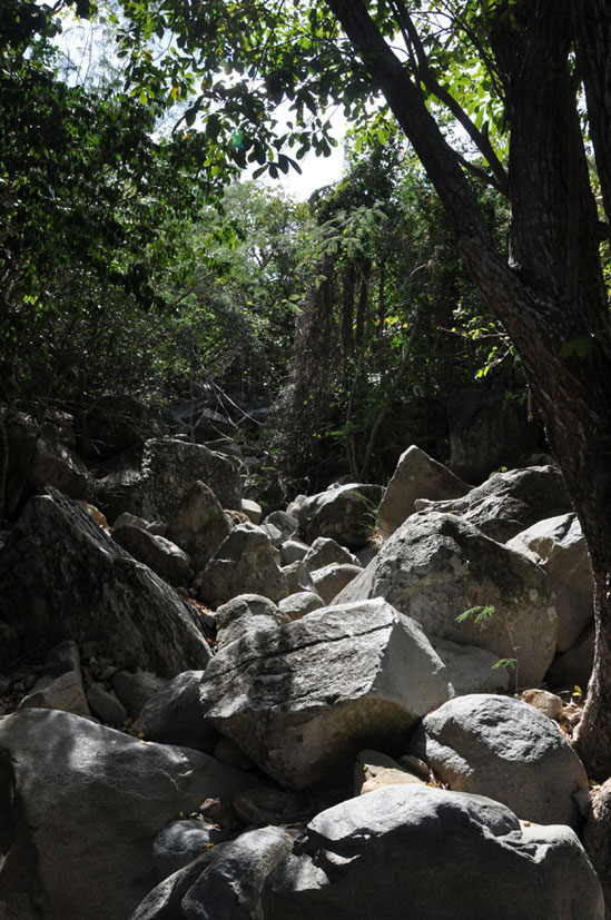
Dry gulches, typically filled with boulders, are often the easiest route through mountain forests that can be quite dense.
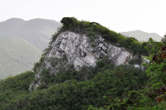
Limestone outcrops are commonly found near the peaks of the central mountains.
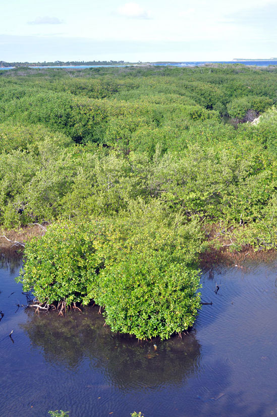
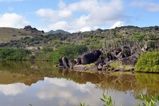
Mangroves and Salt Ponds
Salt ponds and mangrove woodlands are an important ecosystem for many creatures, from birds to fish to invertebrates. They trap nutrients that would otherwise allow algae to overgrow coral reefs while serving as a nursery to many fish species that live there. They counteract coastal erosion and soften the blow of hurricanes.
On St. Martin there are over 20 salt ponds, most of which are surrounded by mangroves, as is a good portion of the large lagoon. The salt ponds are typically connected to the sea either permanently or seasonally. Of course, many wetland areas have been reclaimed (or more accurately, simply claimed) by man. Those that remain are typically highly polluted, but still support a variety of life.
Mangrove woodlands on the island are variously comprised of red mangrove (Rhizophora mangle), black mangrove (Avicennia germinans), white mangrove (Laguncularia racemosa) and buttonwood (Conocarpus erecta), as well as a variety of other plants that are adapted to saline environments.
Species highly dependent upon mangroves and salt pond include the majority of wading birds and waterfowl, iguanas, tropical fish of many varieties and many different invertebrates from crabs to the mangrove buckeye.
While two of the larger salt ponds on the French side and their mangrove woodlands are protected from development as part of the nature reserve, that protection does not include protection against, or the cleanup of, human waste flowing into them. More ominously, large areas of mangrove woodland bordering the lagoon on the Dutch side are being developed by new resorts and an expansion of the airport.
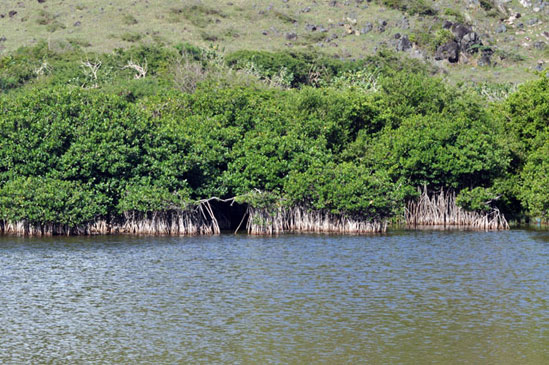
Mangroves ring the small pond near the Grand Case cemetery. Many species not necessarily associated with wetlands are often found here, including the yellow warbler, which is particularly fond of the border between mangrove and scrubland.
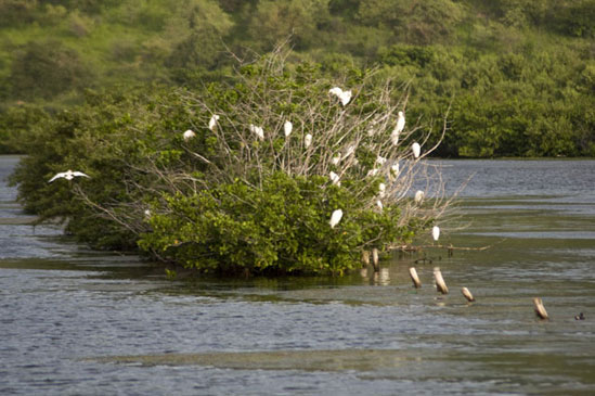
Roosting cattle egrets are a common site in salt pond mangroves, while many other species roost less conspicuously.
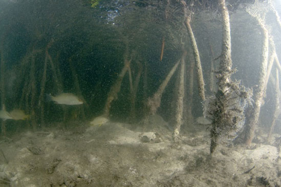
Beneath the surface of the water, mangroves provide a crucial habitat for juvenile fish and crustaceans as well as unique species like the mangrove upside-down jellyfish.
The majority of salt ponds are at least seasonally connected to the surrounding sea. This is primarily done to avoid flooding during hurricanes or other heavy storms.
A large wetland area surrounding Salines d’Orient and Étang aux Poissons on the French side is under a certain degree of protection as part of the nature reserve.
In some areas the vegetation surrounding salt ponds can be quite sparse, in this case resembling the American southwest perhaps more than a tropical island.
Freshwater Habitats
Fresh water is hard to find on Saint Martin. In the land of salt ponds, there are no rivers or freshwater lakes. Instead, there are small ponds, roadside ditches, puddles, wells and abandoned swimming pools. Despite the limited amount of fresh water available on the island, it is highly exploited by the wildlife.
The guppy (Poecilia reticulata), is referred to on the island as the millions because they are so common. With the added advantage of being able to live in brackish water in the salt ponds, they manage to colonize quickly wherever freshwater bodies occur, even temporarily.
Other typical freshwater organisms include many types of insects, including diving beetles, backswimmers, water striders and the larvae of mosquitoes, dragonflies and damselflies. Several types of freshwater snails are present on the island and may easily be found in roadside ditches. Tadpoles are common in almost any still fresh water on the island, but are less common in running water.
Many water sources are anthropogenic, at least in part. Some roadside ditches would not exist without sewage overflow or leaky water mains. The majority of ponds were created to provide water for livestock. Abandoned pools, or even barrels may provide habitat for freshwater organisms.
During the drier months, many freshwater sources may shrink or dry up entirely, making the freshwater lifestyle somewhat dangerous. However, when the rains return these ecosystems come back to life.
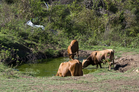
Cattle drink at a freshwater pond in the Bell Hill area. Man made ponds created for livestock are some of the largest and most important habitats for freshwater organisms.
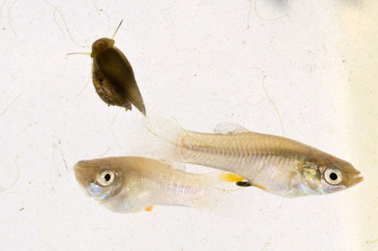
Guppies and aquatic snails are found in many freshwater bodies. Guppies are also able to tolerate salt water, allowing them to colonize any areas where running water is even temporarily connected to a salt pond.
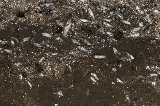
The temporary nature of many freshwater bodies on the island can spell doom for unlucky guppies. These were found in an area where a temporary roadside ditch dried up.
Herons, egrets and other wading birds are often seen hunting for tadpoles and guppies in freshwater ponds like this one at the edge of a pasture.
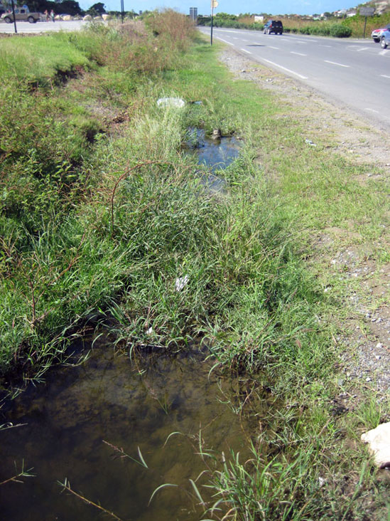
A typical roadside ditch in Hope Estate. Depending on rainfall, it may be a continuous stream, or a collection of separate puddles.
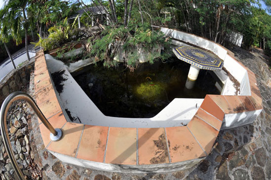
The hot tub at the abandoned La Belle Creole resort serves as a home for two-striped treefrog tadpoles, as well as some guppies, although I have no idea how they got there.
Bat Caves
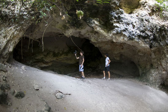
There are currently two caves on the island known to be significant roosting and breeding areas for bats. The smaller cave is located in the cliffs at the top of Billy Folly above the Pelican in Simpson Bay. It can be accessed by taking the road past the Pelican, and a left on Pearl Drive, where you can park at the end of the street. The limestone cliff where the cave is located can be found above a large white villa which bears the improbable name Cleavage. The cave has two openings, a small hole at the top of Billy Folly with a tree growing out of it, and a slightly larger opening at the base of the cave through which you may crawl.
The main chamber is fairly large, perhaps ten meters in diameter and eight meters tall. A small number of bats may be seen roosting on the ceiling of this chamber and occasionally circling the cave. There are also a number of small chambers and holes in the sides of the cave, some of which are large enough for a human to enter.
The larger bat cave is located in the Terres Basses region of the island off Rue Rousseau, near a salt pond called Grand Étang. From the eastern edge of the pond, take approximately 300 paces down Rue Rousseau to the east and head up the hill to your left. Perhaps 100 meters into the forest and up the hill you will find La Grotte du Puits de Terres Basses (roughly translated as the cave of the well of the lowlands).
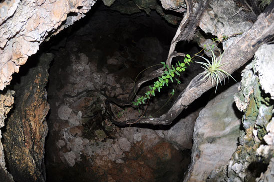
This cave has two large chambers with adjacent openings that are quite large, several meters across and easily tall enough to walk through. The caves are less enclosed than the Billy Folly cave, but much larger and are home to hundreds of bats. The floor of the larger left chamber is covered with the almond seeds and fruit pits, presumably discarded by bats. Cylindrical holes in the ceiling, possibly from previous phosphate mining, host dozens of bats, while in other areas, roosting bats blanket large areas of the ceiling. Multiple species can clearly be seen in this cave, often roosting in mixed aggregations. What I believe to be mothers surrounded by their young are also present.
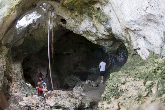
It goes without saying that a visit to the bat caves (despite the stench, mosquitoes and overwhelming eeriness) is one of the most unique and thrilling natural adventures the island has to offer. I truly hope these natural wonders are preserved. Devil’s Hole, the third and largest known bat cave on the island, was filled in during the 1990s.
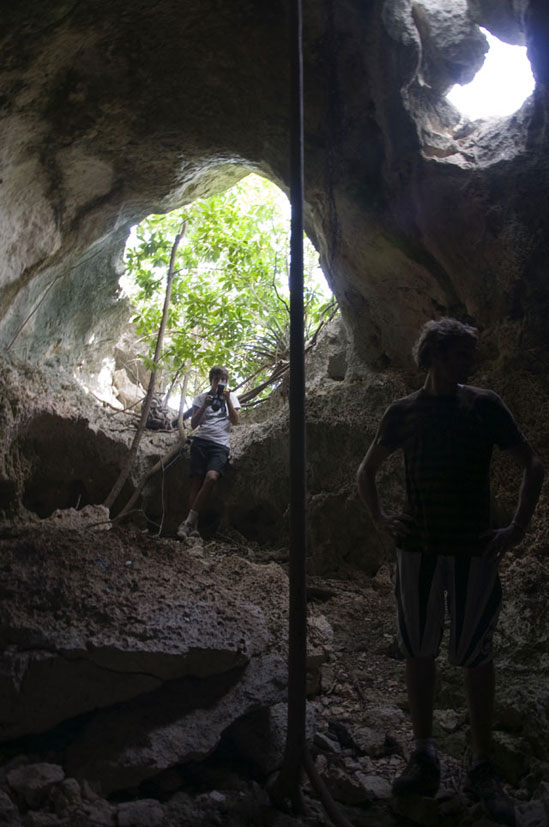
The entrance to the larger chamber of La Grotte du Puits de Terres Basses. The large fan of debris upon which Yann and Marie are standing is probably a remnant of past mining.
A small hole in the ceiling of the Billy Folly cave may be seen from the top of the hill.
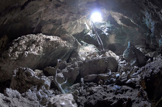
The interior of the main chamber of the Billy Folly bat cave. Sunlight enters through a relatively small hole in the ceiling of the cave.
Several openings in the eastern chamber of La Grotte de Puits allow a fair amount of light into the cave.
Bats in the eastern chamber are concentrated primarily on the ceiling of the darker areas of the cave.
Tintamarre and Pinel
Tintamarre and Pinel are two satellite islands off the French side that are part of the nature reserve. Both are relatively flat and covered primarily with scrubland, although small patches of woodland and thickets are present. While Pinel is quite near shore and serviced by regular ferries, Tintamarre is somewhat less accessible, though still regularly visited. The traditional local name for Tintamarre is Flat Island.
Due to their isolation, the Lesser Antilles as a whole are home to many unique terrestrial species. The reptiles in particular are often studied as an example of adaptive radiation. Likewise, the satellite islands in the Lesser Antilles are similarly interesting. Although Tintamarre and Pinel are not known to harbor any endemic species as is the case for several other satellite islands in the Caribbean, differences in their fauna from that of St. Martin are of interest.
In the case of Tintamarre and Pinel, one interesting difference is the presence on Tintamarre of a separate subspecies of Amieva plei from the St. Martin population (A. plei plei on Tintamarre and A. plei analifera on St. Martin). On Pinel, Amieva seems to be absent entirely.
Satellite islands often fill an important role as the last refuge of endemic species that have become extinct on the main island. Typically this happens when introduced pests, such as the mongoose, are present on the main island but not the satellite. I believe it is possible that Iguana delicatissima, which seems to be completely extinct on St. Martin, may survive on Tintamarre.
Unfortunately, invasive species are not unknown on these satellites. Rats are present on Pinel and Tintamarre, and Tintamarre also has wild goats. Still, with their protected status and relative isolation, these two islets may play an important role in the preservation of St. Martin’s wildlife.
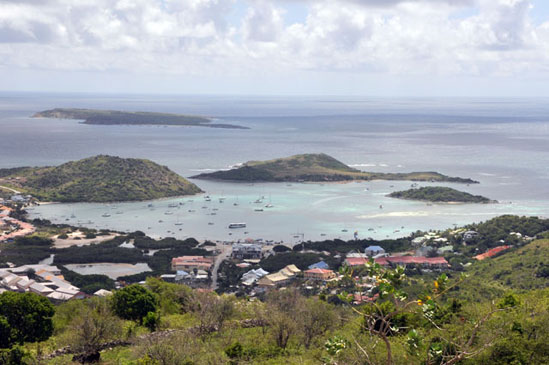
The three islands in this photo are, from left to right, Tintamarre, Pinel and Little Key. All are essentially uninhabited, although Pinel has several businesses operating with the permission of the nature reserve and a residence built before the reserve was established.
Dense thickets are present in small areas of Pinel, offering habitat for animals like the dwarf geckos, which are typically found in the mountain forests.
The scrubland that dominates Pinel and Tintamarre closely resembles that of St. Martin.
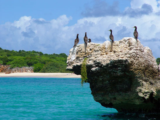
Brown boobies roost on a rock outcrop near the beach on Tintamarre, where they have for years.
Pinel sports a variety of coastal vegetation surrounding an interior comprised mostly of scrubland.
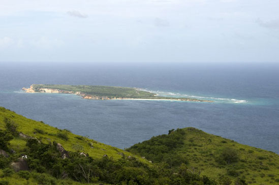
Tintamarre as seen from Wilderness. Both islands are quite flat and lack any significant source of fresh water.
Tintamarre’s coastline features rocky cliffs that are popular nesting sites for various seabirds as well as sandy beaches.